I often use maps in my family history research. Sometimes it’s to get my bearings and understand distances, especially for locations I’m unfamiliar with, or to plan a visit. At other times historic maps are particularly valuable, and I sometimes map out connections to places to help see them through the lens of a different time period, and better understand my ancestors’ lives.
With its origins before 980 A.D., Montrose in Scotland was founded c1130-1140, and was one of Scotland’s principle towns in the thirteenth century. It remains a busy harbour town with one of Scotland’s widest high streets. I used an historic map to highlight selected sites of significance in my ancestors’ lives there between 1871 and 1948.
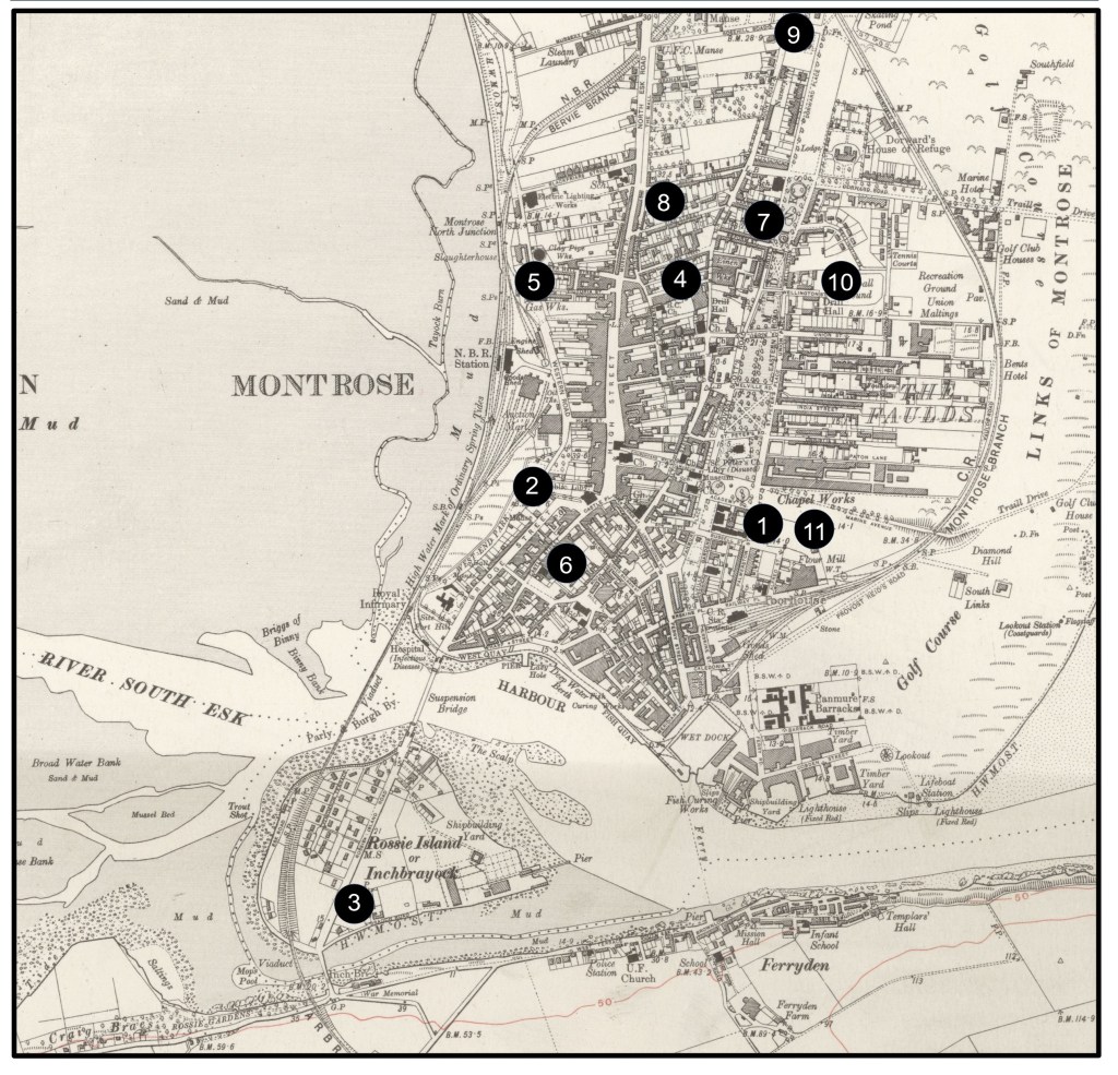
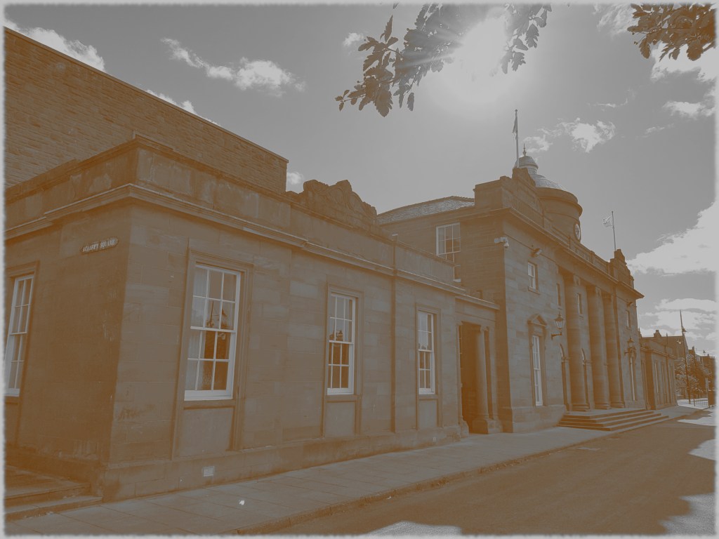
1. Montrose Academy, Academy Square: Secondary school established 1815, attended by my great-grandmother Connie Ritchie 1916-1919. She was acknowledged on the 1917 merit list for achievement in French, science and singing, and participated in school musical and dramatic performances. The school was also attended by Connie’s brother James Ritchie, and cousins James and Robert Ritchie.
2. The Real Pie and Bridie Shop, 15 and 17 Bridge Street: Owned by father and son, James and Thomas Campbell McLean. Their baked goods included Scotland’s horseshoe-shaped hand-held meat pie. James is my 3x great-grandfather.
3. Ivy Cottage, 1 Braoch Road, Rossie Island: Home of my 2x great-grandparents, David and Margaret Ritchie and their family c1921-1924, and where my grandmother was born. Ivy Cottage was described in a To Let advertisement as consisting of “sitting room, kitchen, scullery, washing house, bathroom, and w.c. on the ground floor, with two bedrooms and box room on the second floor. There is also a small garden attached.”

4. Queen Street: Reid Family home c1880s. Birth place of three of my 3x great-grandparents James and Isabella Reid’s children (Elsie, Jessie and Elizabeth)
5. St John’s Cottages: Reid family home c1887. Birth place of James and Isabella Reid’s son William.
6. Castle Street: McLean family home c1870s to 1900s. Located close to the family’s bakery.
7. Reform Street: Home to the Hampton family c1890s.
8. King Street: Home of the Hampton family c1901 – 1948. They lived at number 21 at the turn of the century and number 16 from around 1911 onward.
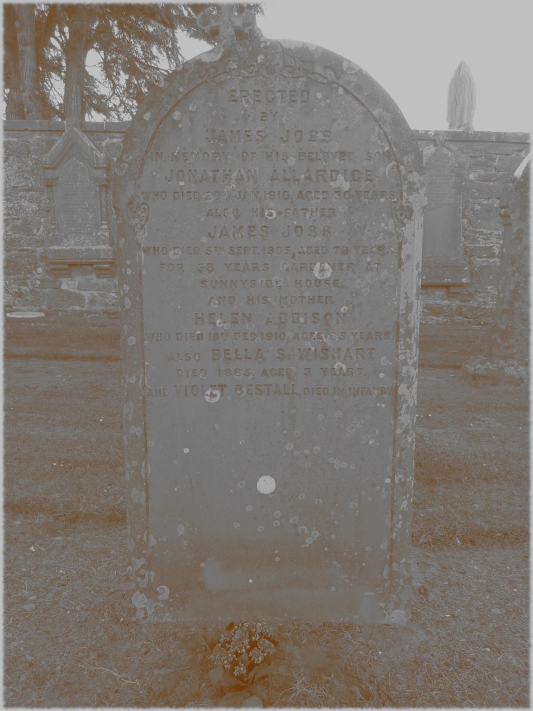
9. Rosehill Cemetery, Rosehill Road: Rosehill Cemetery includes the gravestones of some of my ancestors including from the Hampton, Joss and Addison families.
10. Drill and Recreation Halls, Wellington Street: The site of town events including a large WWI demobilisation celebration at which my great-grandmother Connie Ritchie performed God Send You Back to Me. It was also attended by William Hampton who had served in the 3rd Black Watch.
11. Academy Park Flour Mills, Alfred Street: William Hampton and his brother worked at the mill and were described by a relative as “cheery lads who would always shout out … as she passed [and were] always pure white from head to toe with flour”.

Useful map resources
Visualise your data on a custom map using Google My Maps, https://www.google.com/earth/outreach/learn/visualize-your-data-on-a-custom-map-using-google-my-maps/, accessed 18 October 2025.
Create your own maps and stories in Google Earth, https://blog.google/products/earth/new-google-earth-creation-tools/, accessed 18 October 2025.
Australian maps for family historians, National Library of Australia, https://www.library.gov.au/research/research-guides-0/australian-maps-family-historians, accessed 18 October 2025.
Australian topographic maps research guide, National Library of Australia, https://www.library.gov.au/research/research-guides-0/australian-topographic-maps-research-guide, accessed 18 October 2025.
Understanding colonial maps, University of Tasmania, https://www.utas.edu.au/about/news-and-stories/articles/2021/1123-understanding-colonial-maps, accessed 18 October 2025.
British and Irish maps for family historians, National Library of Australia, https://www.library.gov.au/research/research-guides-0/british-and-irish-maps-family-historians, accessed 18 October 2025.
Maps, National Library of Scotland, https://maps.nls.uk/index.html, accessed 18 October 2025.
A Vision of Britain Through Time, https://www.visionofbritain.org.uk/, accessed 18 October 2025.
MAPCO: Map and Plan Collection Online, https://mapco.net/index.htm, accessed 18 October 2025.
How to look for records of maps and plans, The National Archives, https://www.nationalarchives.gov.uk/help-with-your-research/research-guides/maps-further-research/, accessed 18 October 2025.
Selected references
Town Plans of Montrose, National Library of Scotland, https://maps.nls.uk/towns/montrose.html, accessed 18 October 2025.
Forfarshire sheet XXXV.NW (includes: Craig; Maryton; Montrose) – Ordnance Survey Six-inch 2nd and later editions, Scotland, 1892-1960, https://maps.nls.uk/view/75534587, National Library of Scotland, map reproduced with the permission of the National Library of Scotland, Creative Commons By Attribution 4.0 International.
